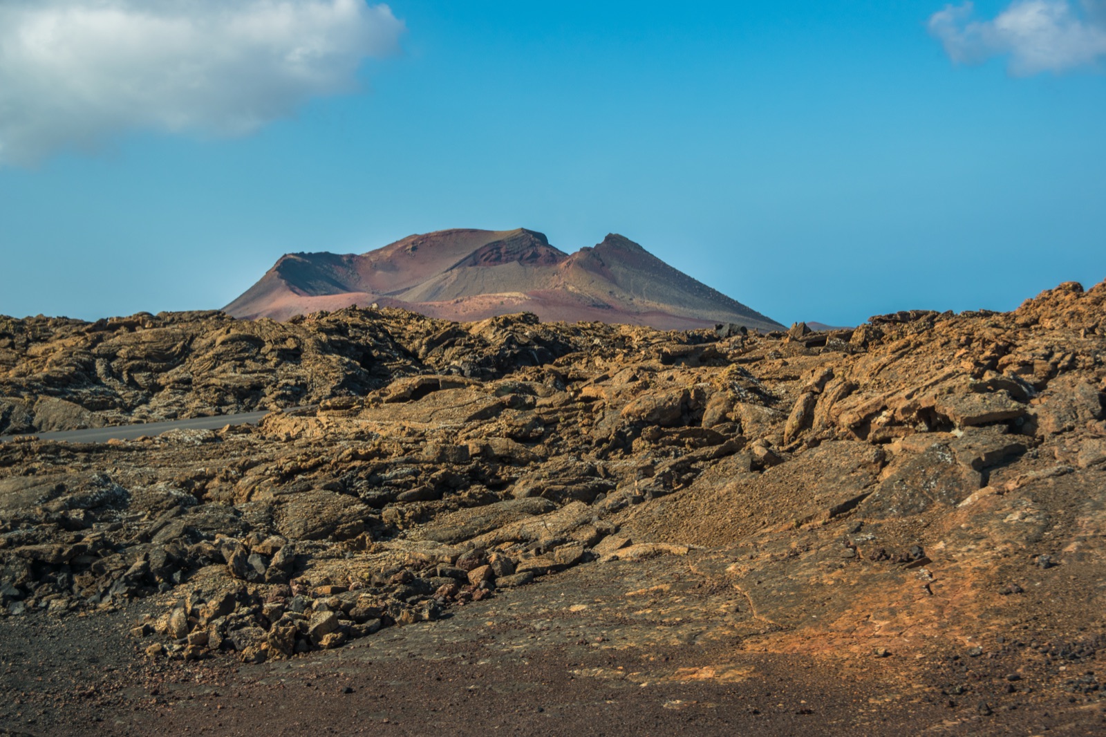
Caldera Blanca and the Free Volcano Walks Next to Timanfaya
You cannot wander freely through Timanfaya National Park, but you can walk on the same eruption next door, for free and without booking. Around the national park lies the Parque Natural de Los Volcanes, crossed by short waymarked trails that take you to the edge of, and even inside, the craters of 1730–1736. The three best are Caldera Blanca, a half-day hike to a giant crater more than a kilometre across; Caldera de los Cuervos, the cone where the whole eruption began, which you can walk into; and Montaña Colorada, the last vent of the series, with a famous volcanic bomb at its foot. The last two take about an hour each.
This guide explains where each trail starts, how long it takes, what you see on the way, what to bring, and how to combine a walk with a visit to the Montañas del Fuego.
The walks at a glance
| Walk | Start | Time | Distance | Difficulty |
|---|---|---|---|---|
| Caldera Blanca | Mancha Blanca, off the LZ-67 at km 13 | about 3 hours (tourism board) to 4¼ hours (Tinajo council) | 9.97 km | Low |
| Caldera de los Cuervos (Volcán del Cuervo) | LZ-56 at km 1.5 | about 1 hour | 2.5 km | Low, suits everyone |
| Montaña Colorada | LZ-56 at km 2.5 | about 1 hour | a loop of the cone | Low, suits everyone |
| Long coastal route (inside the national park) | the park’s west coast | 5–6 hours | 9.75 km | High |
The first three are in the natural park, open all year and free. The long coastal route is inside the national park itself; it is walked freely but it is long and demanding. The park’s other walks are guided and must be booked, as explained further down.
National park or natural park?
The distinction matters, because it decides where you may walk.
- Timanfaya National Park covers 5,107 ha of almost untouched lava from the eruption of 1730–36. Inside it you may not stop your car or get out between the El Taro entrance and Islote de Hilario, and you may not get off the bus on the Volcano Route. Walking is limited to the park’s own routes.
- The Parque Natural de Los Volcanes covers 10,158.4 hectares, a broad band around the national park that reaches the sea in the west. It lies in the municipalities of Yaiza, Tías and Tinajo, and its protected areas include Caldera Blanca, Montaña Colorada and the Volcán del Cuervo. Here the waymarked trails are open to everyone.
The landscape is the same: lava flows, ash fields and cones from the same eruption. In some ways it is better on foot, because you feel the texture of the lava and the scale of the craters in a way that the bus cannot give you.
Caldera Blanca
Why go
Caldera Blanca is a giant volcano with a crater more than a kilometre across, one of the highest points in the volcanic ranges of central Lanzarote. It is older than Timanfaya: when the lava of the eighteenth century flowed around it, it was left standing as an islote, the island word for older ground surrounded by younger lava. Geologists call such places kipukas. From the rim you look down on rivers of lava that flowed through this district between 1730 and 1736.
The route
The walk starts on the edge of the village of Mancha Blanca, where one of Timanfaya’s northern lava tongues came to a stop. From there:
- Across the malpaís. The path heads west across the badlands, a chaotic field of young lava piled in every shape. The 1730 eruption covered the whole centre of the island and destroyed 30 settlements and the best farmland on Lanzarote.
- La Caldereta. The first cone you reach. From the mouth of its crater you see that it is a perfect U shape, broken open in the direction in which the lava flowed. Dry-stone huts, the remains of a cistern and corrals show that the area was once used for livestock.
- Caldera Blanca. The path continues north-west to the base of the great crater. On its west side a path climbs to the rim, from where you can take in the full size of the caldera.
- The return. The trail skirts some small mounds of older rock surrounded by young lava, swings back to Caldera Blanca and then returns to Mancha Blanca the same way it came.
The Tinajo trails are marked out with information panels, so the route is easy to follow.
Time and distance
The sources differ, which is worth knowing before you set out:
- The Canary Islands tourism board lists Caldera Blanca as 9.97 km, about 3 hours, low difficulty and suitable all year, on a fairly flat route that mixes paths, tracks and tarred roads.
- The Tinajo council’s trail sheet gives about four and a quarter hours, starting and finishing at km 13 of the LZ-67.
Most walkers will take somewhere between the two. Allow extra time for the climb to the rim and for the uneven lava, and do not start in the heat of the afternoon.
Where to start and park
There are two common starting points:
- The church of Los Dolores in Mancha Blanca, where the tourism board starts the route. The church’s Virgin is known as the Virgin of the Volcanoes, because one of the northward lava flows stopped here; a cross on a stone niche marks the spot.
- The dirt track at km 13 of the LZ-67, the Tinajo council’s start. Leave Mancha Blanca towards the national park, and park on the dirt track that turns off 150 metres after the village.
While in Mancha Blanca, look out for the remains of an animal-powered grinding mill, a molino de sangre: this is one of the two left in Tinajo.
Caldera de los Cuervos (Volcán del Cuervo)
Where it all began
On 1 September 1730 the Caldera de los Cuervos cone formed. It was the first vent of the Timanfaya eruption, which went on to last more than six years. The vent destroyed the village of Chimanfaya, and before the eruption the area was known as the Vega de Las Vacas, where grain was grown.
The walk
- Start: the car park beside the LZ-56 at km 1.5, the Tinguatón road. The Cabildo describes the car park as being on the Tinguatón–Mancha Blanca road.
- Length: the Cabildo’s environmental-education sheet gives 2.5 km, at a low level, starting and ending at the car park. The Tinajo council gives about 1 hour, low difficulty and suitable for everyone.
- The route: a marked path leads south-west to the base of the cone and round to its north side, where an opening in the north flank lets you walk into the crater. Inside, the vertical walls of solidified lava and pyroclasts take you straight back to the moment of the eruption. You then continue around the base of the cone and back to the car park.
Look out for the large erratic block lying on the lava about 200 m from the breach in the cone, left behind when the cone’s lava lake suddenly emptied.
This is the walk to choose with children. The Cabildo runs it as an education trail for children from the infant stage, ages 3, 4 and 5.
Montaña Colorada
The last vent
Montaña Colorada, named for its reddish lapilli, was the last active vent of the Timanfaya series. Its lava flowed north and threatened the village of Tinajo. When the eruption ended, the villagers built a shrine to the Virgen de Los Dolores where the lava had stopped. The Lanzarote geopark describes the cone close to Los Cuervos as Caldera Colorada, the last cone built, in the final phase of the eruption in April 1736, and notes that Los Cuervos and Caldera Colorada mark the start and end of the largest historical eruption in the Canaries.
The walk
- Start: the car park beside the LZ-56 at km 2.5, just along the road from Los Cuervos.
- Time: about 1 hour, low difficulty, suitable for everyone.
- The route: a well-marked path heads east and then circles the whole cone, with information panels along the way. The geopark notes that a self-guided trail runs around the cone explaining the volcanology of the area.
The highlight is the huge volcanic bomb on the south-east side of the cone. A volcanic bomb is a lump of lava that solidified while spinning through the air, which gives it a rounded or spindle shape. Many large bombs lie around the cone, some still with their impact craters.
Combining the walks
Caldera de los Cuervos and Montaña Colorada start a kilometre apart on the same road, so they make an easy half-day together: one at the beginning of the eruption, one at its end. Caldera Blanca is a longer outing, best on its own in the morning. A sensible plan:
- Short day: Caldera de los Cuervos, then Montaña Colorada, then lunch in Tinajo or Mancha Blanca.
- Long day: Caldera Blanca in the morning, then the Mancha Blanca visitor centre.
- Combined with the park: one of the short walks, then a timed slot at the Montañas del Fuego.
Inside the national park: the park’s own routes
The national park runs free guided walks, which must be booked at least a month in advance:
- Tremesana route: guided, about 3 hours, 3.5 km, low difficulty.
- Short coastal route: guided, 2.5 hours, 2 km, medium difficulty.
The long coastal route is walked freely: 9.75 km, 5–6 hours and graded high. It is a serious walk on rough ground with no shade, and is only for experienced walkers.
Our guide to the park’s walks, camels and visitor centre explains how to book the guided routes.
A guided hike instead
If you would rather walk with a guide and not worry about trailheads or transport, a guided hike across the lava fields covers 9 km at an easy pace in about 3 hours, in the volcano natural park next to the national park, with an optional hotel transfer. It is a good choice if you do not have a car.
What to wear and bring
The volcano country is exposed, dry and sharp underfoot. The national park’s advice applies equally to these trails:
- Footwear: trekking shoes or boots. Lava is abrasive and uneven; sandals are a bad idea.
- Clothing: breathable clothing and a windbreaker. The rims of the craters catch the wind.
- Sun protection: there is no shade, so bring a cap, sunglasses and high-factor sun cream.
- Water and food: always carry water or other drinks and some food. For Caldera Blanca the tourism board says to take enough to drink for a three-hour walk.
Photographs on the trails
The free trails are where you can take the photographs the bus cannot give you. A few ideas:
- Inside Los Cuervos. The crater walls frame the sky; a wide lens helps.
- The bomb at Montaña Colorada. Stand a companion beside it to show its size.
- The rim of Caldera Blanca. The best view of the lava rivers from 1730–1736 winding between the older cones. Early or late light brings out the colours of the ash.
- La Caldereta. Its U shape is clearest from the mouth of the crater.
Keep to the path for every photograph, and remember that the park asks visitors not to fly drones.
Walking safely on lava
- Stay on the path. The more viscous aa lava cools into a rough, jagged surface, the malpaís, which is very hard to walk on. A twisted ankle a long way from the road is a real risk.
- Always walk on the same path. The park asks walkers to keep to the trodden line so the landscape stays unaltered.
- Take nothing. Do not take away stones or other volcanic material, and do not pile stones into the little “towers” that visitors build.
- No drones. The park asks visitors not to fly them.
- Watch the weather. Wind on the rims can be strong, and in summer the dark ground radiates heat.
When to walk
The tourism board rates Caldera Blanca as a walk for all year. In practice:
- October to May is the most comfortable time.
- June to September, start early. There is no shade, and the dark lava gets hot.
- Winter is windier on the high ground, so take a layer.
Our best time to visit guide has the month-by-month climate.
Getting to the trailheads
- By car: the easiest way. The LZ-67 links Tinajo and Yaiza and serves all the park’s facilities; the LZ-56 runs from it towards Tinguatón past the Los Cuervos and Montaña Colorada car parks.
- By bus: no public bus goes into the national park, but line 16 runs Arrecife – San Bartolomé – Mozaga – Tao – Tiagua – La Vegueta – Mancha Blanca – Tinajo – La Santa. That makes Caldera Blanca, which starts in Mancha Blanca, the walk best placed for the bus.
- By taxi: from Tinajo or Yaiza to the trailheads.
See getting to Timanfaya for the driving routes from each resort.
Pairing a walk with the Montañas del Fuego
The trails sit on the same road as the park’s facilities, which makes it easy to combine them:
- Mancha Blanca visitor centre: LZ-67 at km 9.6, open daily 9:00 to 16:00. Its exhibitions on the eruption make a good introduction before a walk.
- Montañas del Fuego: LZ-67 at km 13.8. Book a timed slot online and arrive 15 minutes early.
- Echadero de los Camellos: LZ-67 at km 16, for a camel ride after the bus.
Our ticket and Volcano Route guide explains the visit, and the Lanzarote volcanoes article tells the story of the eruptions you are walking on.
Frequently asked questions
Can you walk in Timanfaya National Park?
Only on the park’s own routes: two free guided walks booked a month ahead, and the long coastal route. The Montañas del Fuego are seen by bus. The trails in this guide are in the natural park next door and are open to all.
How long is the Caldera Blanca hike?
The tourism board lists 9.97 km and about 3 hours; the Tinajo council allows about four and a quarter hours. Plan for half a day.
Is Caldera Blanca difficult?
It is graded low, but the lava is uneven and there is a climb to the rim. Wear proper shoes and carry water.
Can you go inside a crater?
Yes. At Caldera de los Cuervos an opening in the north flank lets you walk into the crater of the cone that began the eruption.
Which walk is best with children?
Caldera de los Cuervos: about an hour, low difficulty, and used by the Cabildo as an education trail for children aged 3, 4 and 5.
Do I need a ticket or permit?
Not for Caldera Blanca, Los Cuervos or Montaña Colorada. The park’s guided walks are free but must be booked at least a month ahead.